
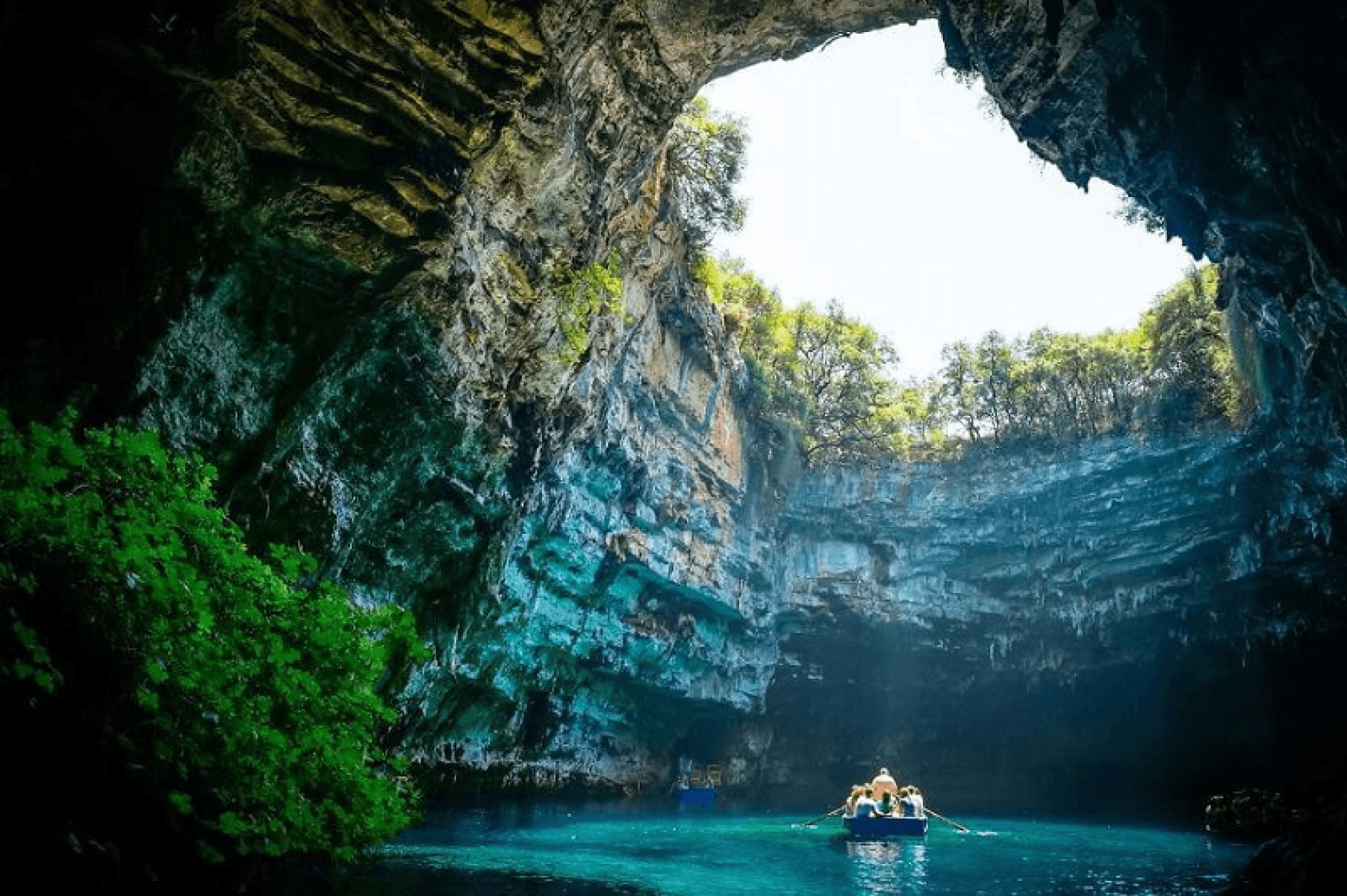
Overview of Phong Nha - Ke Bang National Park
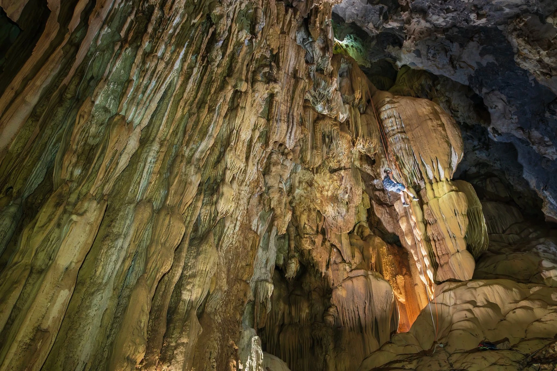
Geographically, Phong Nha - Ke Bang National Park, a UNESCO World Natural Heritage Site, is located between 17°21′ and 17°39′ North latitude and 105°57′ and 106°24′ East longitude. The park is situated within the areas of Tan Trach, Thuong Trach, Phuc Trach, and Xuan Trach communes, as well as Phong Nha Town, Bo Trach District, Quang Binh Province. The entrance to Phong Nha Cave is located at 17°34'54.15"N and 106°16'58.83"E.
Phong Nha - Ke Bang National Park covers an area of 123,326 hectares and is divided into three functional zones: the Strict Protection Zone (100,296 ha), the Ecological Restoration Zone (19,619 ha), and the Administrative and Service Zone (3,411 ha).
The park is also renowned for seven remarkable distinctions: the highest and widest cave entrance, the most beautiful underground sandbank and rock formations, the most beautiful underground river, the most beautiful underground lake, the most spectacular and magnificent stalactites, the largest and most beautiful dry cave, and the longest water cave.
In 2003, UNESCO recognized Phong Nha - Ke Bang National Park as a World Natural Heritage Site for its outstanding geological and geomorphological values. On July 3, 2015, the park was recognized by UNESCO for the second time as a World Natural Heritage Site, this time based on its exceptional biodiversity values.
On July 13, 2025, during the 47th session of the World Heritage Committee held in Paris, UNESCO officially approved the expansion of the boundaries of the Phong Nha - Ke Bang World Natural Heritage Site in Vietnam. This adjustment included Hin Nam No National Park in Khammouane Province, Laos, creating the first Transboundary World Heritage Site named “Phong Nha - Ke Bang National Park and Hin Nam No National Park.”
On June 5, 2026, during the 38th session of the International Coordinating Council of UNESCO's Man and the Biosphere Programme (MAB-ICC), held in Hernandarias, Paraguay, Phong Nha - Ke Bang National Park was officially recognized by UNESCO as a World Biosphere Reserve and became part of the World Network of Biosphere Reserves.
This designation recognizes the outstanding global values of Phong Nha - Ke Bang in terms of biodiversity, ecosystems, and natural landscapes, while also highlighting ongoing efforts to combine nature conservation with sustainable local development. This marks the third time Phong Nha - Ke Bang has received international recognition from UNESCO, further strengthening its position as one of Vietnam's and the world's leading destinations for nature, exploration, and adventure.
Why Is It Called Phong Nha - Ke Bang?
When the area was still known as the Xuan Son Nature Reserve, conservation efforts focused primarily on protecting a 5,000-hectare area with a high level of biodiversity under the state management of the Ministry of Forestry, later renamed the Ministry of Agriculture and Rural Development. The agencies directly responsible for researching biodiversity resources were the Forest Planning Institute and the Forest Resources and Environment Center.
Within the boundaries of the nature reserve lies Phong Nha Cave, which possesses both outstanding scenic value and prehistoric cultural heritage associated with the Vietnamese people and Cham culture. As a result, the cave had already attracted visitors during the French colonial period. At that time, tourism activities were managed by the Department of Culture and Information.
As part of its management responsibilities, in 1995, the Department of Culture and Information organized a national conference on promoting the natural and cultural values of the Xuan Son Nature Reserve, with the participation of UNESCO representatives. At the conference, Dr. Nguyen Khac Thai presented a paper entitled: “A Broader Perspective on the Xuan Son Nature Reserve and a Proposal to Adopt the Name ‘Phong Nha - Ke Bang’ for the Future National Park.”
Meaning of the Name Phong Nha - Kẻ Bàng
The National Park must ensure a sufficiently large area to satisfy the criteria of "Integrity of the Heritage," meaning it must encompass all heritage values for complete protection before UNESCO grants recognition. Meanwhile, expanding the area to 147,000 hectares of core zone and 200,000 hectares of buffer zone encompasses the districts of Bố Trạch, Minh Hóa, a strip of Quảng Trạch and Quảng Ninh, and Đồng Hới, making it difficult to harmonize any single name for the National Park. Therefore, Mr. Nguyễn Khắc Thái proposed using "Kẻ Bàng," a place name designating the mountainous region in northwestern Quảng Bình, as the name.
Kẻ Bàng is the name of an ancient village. In the past, ancient villages all had two prefixes at the beginning, either "kẻ" or "Cổ" (such as Cổ Giang, Cổ Lạc, "Kẻ Sót"...). This village no longer exists later on, and local people used that name to generally refer to the mountainous region above it as Kẻ Bàng.
And why attach Phong Nha? Because although Phong Nha is a small village, the fame of Phong Nha Cave dates back to the French colonial period, whereas Kẻ Bàng was unknown to anyone. Thus, attaching a famous place name makes it known to everyone.
History of Phong Nha - Kẻ Bàng
The cave system in the Phong Nha - Kẻ Bàng area was formed by geological tectonics occurring within the Kẻ Bàng limestone mountain range. Specifically, the karst tectonics of the Phong Nha - Kẻ Bàng National Park were formed 400 million years ago, dating back to the Paleozoic Era, making it the oldest karst in Asia. Through important tectonic periods, phases of faulting, folding, and block movements successively created towering mountain ranges due to uplifting movements and sedimentary basins due to subsidence movements, acting as the root cause of the diversity in topography, geomorphology, geology, hydrological networks, and the fascination and diversity of caves for the Phong Nha - Kẻ Bàng limestone formations developing from the Devonian to the Carboniferous - Permian periods.
The present-day Phong Nha - Kẻ Bàng area is the comprehensive result of 5 major stages in the history of Earth's crust development in the region:
Late Ordovician to Early Silurian period (450 million years)
Middle and Late Devonian period (about 340 million years)
Carboniferous - Permian period (300 million years)
Orogenic phase
Cenozoic Era (250-65 million years)
The initial cause can be attributed to the upwelling activity of volcanic intrusive bodies younger than the limestone. These bodies, along with uplifting the limestone layer to its present height, also triggered earthquakes, faults, and volcanism. At the intersections of faults or major fault zones and upwelling volcanism, the limestone was metamorphosed into quicklime (CaO), which is easily soluble in water, while introducing breccia, pebbles, volcanic lava, and groundwater into the cracks and faults of the limestone. In an aqueous environment, this lava turned into soft mud and kaolin clay, easily eroded by water or settled into cracks and cavities due to being 0.3 - 0.4 g/cm3 denser than limestone. Water played the role of cleaning out the interior of the caves and the valleys between the limestone mountains (washing away mud, quicklime, mud, and kaolin clay) and forming the stalactites and stalagmites we see today.
Phong Nha - Kẻ Bàng National Park originated as the Xuân Sơn special-use forest, established under Decision No. 194/CT dated August 9, 1986, by the Chairman of the Council of Ministers (now the Prime Minister), deciding to establish a Cultural and Historical Site with a total area of 5,000 hectares. Xuân Sơn was Quảng Bình's first special-use forest aimed at conserving the primary forest ecosystem on limestone mountains, while being associated with historical relics of the Vietnamese nation.
1993: The Xuân Sơn special-use forest was renamed the Phong Nha Nature Reserve under Decision No. 964/QĐ-UB dated December 5, 1993, by the People's Committee of Quảng Bình Province, with a total area of 41,132 hectares.
1999: The National Park was invested and proposed for expansion to include the Kẻ Bàng limestone mountain range to the northwest and proposed for management category adjustment from a nature reserve to a National Park.
2001: Phong Nha - Kẻ Bàng National Park was established under Decision No. 189/TTg by the Prime Minister on December 12, 2001. According to the Prime Minister's Decision, the National Park has a total area of 85,754 hectares, of which the Strictly Protected Zone covers 64,894 hectares, the Ecological Restoration Zone covers 17,449 hectares, and the Administrative-Service Zone covers 3,411 hectares. After upgrading to a National Park, the organizational structure of the Nature Reserve Management Board was also adjusted to become the National Park Management Board under Decision No. 24/QD-UB by the People's Committee of Quảng Bình Province on March 20, 2002.
2003: At the 27th plenary session of the World Heritage Committee at UNESCO Headquarters (Paris) from June 30 to July 5, 2003, UNESCO officially recognized Phong Nha - Kẻ Bàng National Park as a World Natural Heritage site under criterion (viii): representing globally outstanding geological, geomorphological, and geographical values.
2009: Phong Nha - Kẻ Bàng National Park was recognized as a Special National Relic under Decision No. 1272/QĐ-TTg dated August 12, 2009, by the Prime Minister.
2012: The Quảng Bình People's Committee issued Decision No. 36/2012/QĐ-UBND on December 28, 2012, stipulating the functions, powers, tasks, and organizational structure of the Management Board of Phong Nha - Kẻ Bàng National Park (replacing Decision No. 65/2003/QĐ-UB dated November 28, 2003, of the Quảng Bình People's Committee on reorganizing the management apparatus).
2013: The Prime Minister issued Decision No. 1062/QĐ-TTg on July 5, 2013, adjusting the boundary of Phong Nha - Kẻ Bàng National Park from 85,754 hectares to a total area of 123,326 hectares (an increase of 30,570 hectares).
2015: At the 39th session held on July 3, 2015, in Bonn, Federal Republic of Germany, with the consensus of member states of the World Heritage Committee (WHC), Phong Nha - Kẻ Bàng National Park was inscribed for the second time by UNESCO into the World Heritage List with 2 new criteria: representing significant ongoing ecological and biological processes in the evolution and development of terrestrial ecosystems (criterion IX); containing the most important natural habitats for in-situ conservation of biological diversity (criterion X).
2025: At the 47th session held on July 13, 2025, in Paris, France, with the consensus of member states of the World Heritage Committee (UNESCO), the Phong Nha - Kẻ Bàng National Park World Natural Heritage and Hin Nam No National Park (Khammouane Province, Laos) were officially recognized as a Transboundary World Natural Heritage.
2026: On June 5, 2026, at the 38th session of the International Coordinating Council of UNESCO's Man and the Biosphere Programme (MAB-ICC) held in Hernandarias, Paraguay, Phong Nha - Kẻ Bàng National Park was officially recognized by UNESCO as a World Biosphere Reserve, becoming a member of the World Network of Biosphere Reserves.
Why a National Park?
The initial value identified for the Xuân Sơn Nature Reserve was biodiversity. However, this diverse ecosystem is not confined to 5,000 hectares, nor even an expanded 41,000 hectares; instead, this population possesses a vast ecological area spanning both sides of the East - West Trường Sơn mountain range comprising 400,000 hectares, of which 200,000 hectares are in Quảng Bình and 200,000 hectares in Khammouane. Organisms have habitats for living, foraging (animals), and spreading genetic sources (plants) across that entire region. Therefore, if confined only to the Xuân Sơn area, the remaining non-protected areas would be exploited, and biodiversity would gradually decline. Thus, it must be expanded to cover the entire space where genetic sources exist.
Beyond the scope of the Xuân Sơn Nature Reserve, there are two other values that this Nature Reserve cannot protect and exploit: the characteristic karst geological and geomorphological values, and the landscape values (cave systems and forest ecological landscapes). These two values lie within and extend beyond the 41,000-hectare area. Therefore, expansion is necessary.
With three major values of such global significance, the "NATURE RESERVE" level lacks sufficient administrative sanctions, functions, and duties to manage them, hence it had to be upgraded to a National Park.
Cave System of Phong Nha - Kẻ Bàng National Park
The Phong Nha cave system has a total length of over 45km, originating from the southern part of the Kẻ Bàng limestone mountain range. The main entrances of this system are Hang Én and Hang Khe Ry, located at an altitude of about 300m above sea level, ending with Phong Nha Cave, which has a total length of nearly 45 km. The caves in this system are distributed in a Northeast - Southwest direction, running in a dendritic pattern, including the following caves:
Dark Cave (Hang Tối): located on the upper reaches of the Son River with a length of 5,258 m and a height of 83 m, 736 m long.
Trạ An Cave: 667m long and 15m high.
Thung Cave: a cave with an underground river flowing for 3,351m.
Swallow Cave (Hang Én): 1.6km long with cave arch sections up to 140m high and nearly 200m wide; features long sandy beaches and an interior lake, serving as a habitat for swallows.
Khe Tiên Cave: 520m long, located to the south of Phong Nha.
Khe Ry Cave: located to the south of Phong Nha.
Khe Thi Cave.
Vòm Cave System
Vòm Cave: 15.05km long, 145m high, with many beautiful stalactites.
Đại Cáo Cave: 1,645m long and 28m high.
Duột Cave: 3,927m long, 45m high, with fine sandy beaches.
Cá Cave: 1,500m long, 62m high.
Hổ Cave: 1,616m long and 46m high.
Over Cave: 3,244m long and 103m high with a width ranging between 30–50m.
Pygmy Cave: 845m long.
Rục Cà Roòng Cave: The habitat of the Arem ethnic minority who live in caves and engage in natural hunting and gathering.
Conservation Work
To strengthen the management and sustainable conservation of geological, geomorphological, ecosystem, and globally threatened flora and fauna values within the Phong Nha - Kẻ Bàng heritage area; while developing sustainable ecotourism and contributing to enhanced economic benefits, several conservation efforts have been and are being implemented, such as:
Dissemination, legal promotion, and awareness raising: Integrated into village/commune collective meetings; maintaining conservation club activities at the grassroots level; distributing communication materials and publications, placing promotional billboards; organizing extracurricular activities in schools within the buffer zone; training communication and biodiversity conservation skills for collaborators in communes and teachers of secondary schools in the buffer zone; organizing conferences at all levels to propagate wildlife protection, Phong Nha - Kẻ Bàng forest protection, and management work... Additionally, tourism exploitation units also conduct environmental impact assessments and environmental monitoring in accordance with regulations; planning waste collection and treatment at tourism routes and destinations.
Patrolling and handling violations: Strengthening the detection and handling of acts infringing upon biodiversity, aiming to timely prevent illegal resource exploitation activities and minimize other threats to the national park's biodiversity, such as logging, wildlife hunting, illegal entry into forests, building shacks...
Conservation and coordination in biodiversity conservation: Implementing numerous research topics and projects on biodiversity to create a premise for proposing solutions serving conservation and ecosystem development. Furthermore, agencies and departments have signed various coordination regulations on forest protection, forest fire prevention and fighting, illegal transportation and trading of forest products, and combating cross-border smuggling forms.
Wildlife rescue: Besides receiving and rescuing thousands of individual wild animals (including many endangered and rare species such as Hatinh langur, red-shanked douc langur, masked palm civet, southern yellow-cheeked gibbon, pangolin, pygmy slow loris, stump-tailed macaque, rhesus macaque, turtles, pythons...) and releasing them back into the natural environment. The site also collects, supplements, and curates specimens of 169 plant species as herbarium specimens to serve exhibition and interpretation work at the Botanic Garden.
Values of the Phong Nha - Kẻ Bàng National Park World Natural Heritage
Geology - Geomorphology This area contains evidence of the formation and tectonic history of the Earth's crust with 5 tectonic processes from the Ordovician to the Carboniferous - Permian periods. Phong Nha - Kẻ Bàng is part of a vast dissected plateau, comprising the Kẻ Bàng limestone mountainous area and Laos's Hin Namno National Park. This plateau is a typical example, carrying the most characteristic features of complex karst terrain in Southeast Asia. Limestone tectonics were formed from the Paleozoic Era (over 400 million years ago) and constitute the largest and oldest limestone area in Asia. It features two main types of terrain, including karst and non-karst terrain. The characteristic of Phong Nha - Kẻ Bàng National Park is that the core area is largely limestone mountains (karst terrain, accounting for 2/3 of the area). Dubbed the "Kingdom of Caves," Phong Nha - Kẻ Bàng has over 368 caves with a total surveyed length of over 231km. Among them, Son Doong Cave was assessed by the British Vietnam Caving Expedition Team as the largest cave in the world, and a deepest karst sinkhole in Vietnam (with a depth of over 255 m, potentially the deepest in Southeast Asia) was also discovered. Son Doong Cave is not only known as the largest cave in the world but also as a cave with representative geological and geomorphological characteristics.
Ecosystem Phong Nha - Kẻ Bàng possesses 15 habitat types with 10 important vegetation types. Closed evergreen forests cover 93.5% of the area, of which over 90% of the National Park's area is a rare, typical tropical limestone forest ecosystem that remains mostly undisturbed. This is one of the National Parks with the highest primary forest ratio and forest cover in Vietnam's special-use forest system. Notably, the existence of a 500-year-old Fujian cypress population, covering about 4,000 hectares, growing mainly on limestone mountains at altitudes above 600 m, is considered the most unique forest habitat of global importance and conservation value. The Fujian cypress is an ancient and endemic plant species of Vietnam, currently surviving mainly in Phong Nha - Kẻ Bàng National Park.
Animal Diversity This place houses 1,394 animal species belonging to 835 genera, 289 families, 68 orders, 12 classes, 4 phyla, of which 82 species are in the Vietnam Red Data Book; 116 species are listed in the IUCN Red List; 39 species are recorded in Decree No. 64/2019/NĐ-CP; 66 species are listed in CITES appendices. In addition, over the past 20 years, 42 new species have been successively recorded and published worldwide, including 38 animal species and 4 plant species.
Plant Diversity The area records 2,952 vascular higher plant species belonging to 1,007 genera, 198 families, 63 orders, 12 classes, 6 phyla, of which 111 species are in the Vietnam Red Data Book; 121 species are listed in the IUCN Red List; 3 species are named in Decree No. 64/2019/NĐ-CP dated July 16, 2019, of the Government.
Cultural - Historical Heritage Inside Phong Nha Cave, there are traces of Cham altars worshiping the Cave Guardian God along with a long-broken stone Cham statue. In Rào Cave in Southeast Rào Té, a tributary of the Troóc River, there are piles of mountain and freshwater snail shells mixed with tortoise shells and animal bones. These are traces from the meals of ancient Quảng Bình people. In Khe Tong Cave on the right bank of Khe Gát, the cultural layer contains stone tools with chipping marks, snail shells, animal bones, and broken pottery. The pottery here features wave patterns and cord marks, proving that ancient Quảng Bình people possessed a fairly high level of civilization.
Activities of the Phong Nha - Kẻ Bàng National Park Management Board
Currently, the Management Board has departments and affiliated agencies functioning to assist the leadership board:
Organization - Administration Department The Organization - Administration Department has the function of advising and assisting the Director of the Park Management Board on personnel organization, emulation and commendation, discipline, regimes and policies for civil servants and employees; administrative work, accounting, militia and self-defense training, and other administration.
Planning - Finance Department The Planning - Finance Department has the function of advising and assisting the Director of the Park Management Board in performing tasks in the fields of: formulation and implementation of master plans and plans related to the conservation and promotion of the National Park's values; management of tourism activities taking place in the National Park; investment in construction and provision of facilities, implementation of forest environmental service payment policies in the National Park in accordance with the law.
Science and International Cooperation Department Has the function of advising and assisting the Director of the Park Management Board in performing tasks of scientific research, information technology, transfer of technical procedures, and cooperation with international organizations in the fields of biodiversity conservation, environment, geology, geomorphology, hydrology, historical and cultural relics, and sustainable development of resources within the operating scope of the Park.
Phong Nha - Kẻ Bàng Tourism Center This is a public service unit directly under the Phong Nha - Kẻ Bàng National Park Management Board. Function: Organizing the exploitation and management of tourism activities and tourism services at routes and tourist sites, including: Phong Nha Cave, Tiên Sơn Cave, Memorial Temple for Truong Son Martyrs on Road 20 Quyet Thang (Eight Ladies Cave), Nurse Cave, Moọc Water Spring, Chày River - Dark Cave, and other tourist routes and destinations assigned by the Director of the Park Management Board.
Rescue, Conservation, and Organism Development Center Has the function of advising and assisting the Director of the Park Management Board in rescue, conservation, organism development, and environmental education activities. Helping raise awareness for the local community, tourists, and other subjects when visiting, studying, and researching at Phong Nha - Kẻ Bàng National Park. In addition, this unit organizes the reception and rescue of native organisms or species suitable for the natural habitat of Phong Nha - Kẻ Bàng National Park, or species permitted for scientific research under topics approved by competent state agencies, confiscated from law violations, or voluntarily surrendered by organizations and individuals. Furthermore, this center also conducts rescue breeding and semi-wild breeding of wild animals for release back into the natural environment and for scientific research. At the same time, it re-releases organisms that meet the conditions to return to their natural habitat after being rescued at Phong Nha - Kẻ Bàng National Park. Transferring to other rescue facilities nationwide for individual organisms that the Center does not have sufficient conditions to rescue or that are unsuitable for the natural environment of Phong Nha - Kẻ Bàng National Park.
Forest Protection Station Includes functions: Organizing the protection of forest resources, preventing forest clearing; forest fire prevention and fighting; preventing and controlling forest pests and diseases within the forest land of Phong Nha - Kẻ Bàng National Park. Conducting inspections and handling acts of law violation regarding forest protection and development in accordance with the law. Presiding over and coordinating with local authorities and other functional agencies and units stationed in the area to disseminate, educate laws, and propagate and mobilize people to participate in forest protection work; inspecting and supervising production, business, and travel activities of people and vehicles in the area managed by the Station; detecting, rectifying, and handling violations in accordance with the law.
Natural Resources of Phong Nha - Kẻ Bàng National Park
Location: located in Quảng Bình province, central Vietnam; with geographical coordinates: 17°21'12" to 70°44'51" North latitude; 105°46'33" to 106°23'33" East longitude.
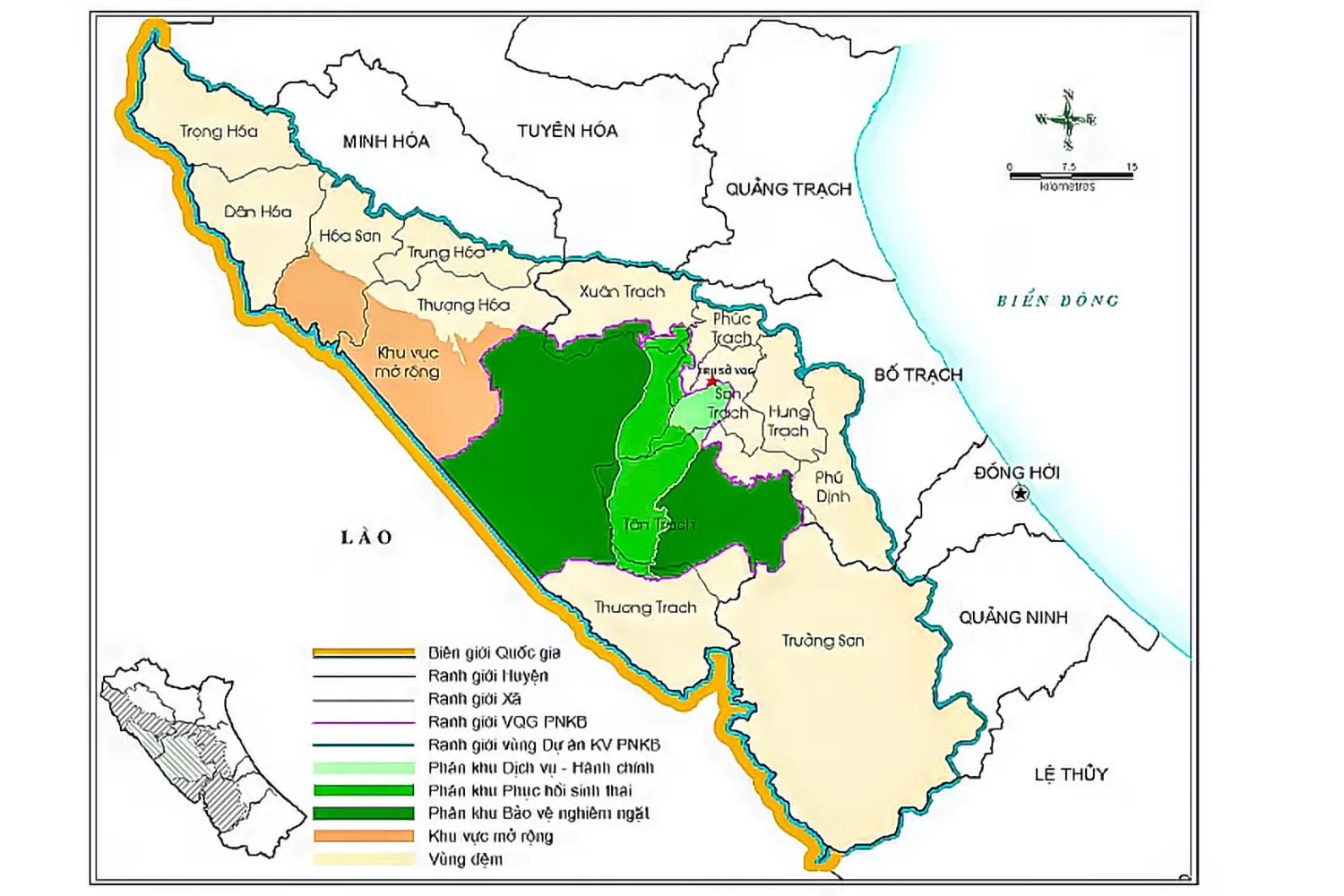
Area: 123,326 hectares, comprising 03 zones: strictly protected zone (100,296 hectares); ecological restoration zone (19,619 hectares); administrative-service zone (3,411 hectares).
Buffer zone with an area of 219,855.34 hectares covering 13 communes (including Dân Hóa, Hóa Sơn, Trung Hóa, Thượng Hóa, Trọng Hóa communes in Minh Hóa district; Tân Trạch, Thượng Trạch, Xuân Trạch, Phúc Trạch communes, Phong Nha town, Phú Định commune, Hưng Trạch commune in Bố Trạch district, and Trường Sơn commune in Quảng Ninh district).
UNESCO Ranking: World Natural Heritage under criterion (viii) for geology and geomorphology (2003); extended recognition under criterion (ix) for ecosystems and (x) for biodiversity (2015); recognized by UNESCO as a World Biosphere Reserve (2026).
National Ranking: Special National Relic (in 2009).
Geology – geomorphology: Phong Nha – Kẻ Bàng is evaluated by experts as a gigantic geological museum with many rare values of global significance, with the majority of the area being limestone. This National Park links with the Hin Namno national biodiversity conservation area in Khammouane province, Lao PDR, creating a large Karst block in Southeast Asia. This area today is the result of the development of 5 geological tectonic stages, from the Ordovician period (464 million years ago) to the Quaternary. This has been evaluated and proven through rich and diverse paleontological fossil complexes representing various stratigraphic ages.
Caves: 404 caves have been surveyed and mapped with a total length of 220km; divided into three main systems: Phong Nha system, Vòm system, and Chày system. The Phong Nha – Kẻ Bàng cave system is assessed to have top global value for preserving the integrity of geological and geomorphological values formed from long-term Earth's crust tectonic processes; prominent are Son Doong Cave, Phong Nha Cave, Tiên Sơn Cave, Thiên Đường Cave, and Hòa Hương, etc.
Hydrology: 03 main rivers including Chày River, Son River, and Troóc River, supplied mainly by the system of karst underground rivers and streams flowing out at points at Hang Én, Vòm Cave, Tối Cave, and Phong Nha Cave....
Vegetation cover: Comprising 15 broad habitat types with 21 important vegetation types. Closed evergreen forests cover 93.5% of the area, of which over 90% is a tropical limestone forest ecosystem that is the largest in Southeast Asia and mostly undisturbed.
Flora: Recording 2,952 plant species belonging to 1,006 genera, 198 families, 62 orders, 11 classes, 6 phyla, including 112 species listed in the Vietnam Red Data Book, 121 species listed in the IUCN Red List, 01 species in CITES appendices, 03 species in Decree 64/2019/NĐ-CP.
Fauna: Recording 1,394 animal species belonging to 835 genera, 289 families, 66 orders, 12 classes, 4 phyla, including 84 species recorded in the Vietnam Red Book, 110 species recorded in the IUCN Red List, 55 species named in CITES appendices, 40 species named in Decree 64/2019/NĐ-CP. Among them are some rare and endangered animal species, such as Hatinh langur, red-shanked douc langur, white-cheeked crested gibbon, saola, muntjac, etc.
New species: This area is where many new species for science were recorded in the early 21st century; 42 new species have been published worldwide, including 38 animal species and 04 plant species.
Buffer zone population: 68,501 people (as of December 2020); average population density 19.96 people/km2.
Ethnic groups: Besides the Kinh people accounting for 83.1% of the total population, the area is also home to other groups of 2 main ethnicities: the Chứt ethnic group (accounting for 4.3%, including Sách, Mày, Rục, A rem groups) and the Vân Kiều ethnic group (accounting for 12.6%, including Vân Kiều, Khùa, Ma Coong, Trì groups).
Historical - cultural relics: Xuân Sơn Ferry Terminal, Ho Chi Minh Trail, Road 20 Quyet Thang, Mu Gia Pass, A.T.P, Tra Ang, Ca Tang, Cua Chu A, Khe Ve, Hang Tám Cô, Chin Tang Cave, Nguyen Van Troi Ferry Terminal, Tien Su Tu Coc Temple.
Festivals and Traditional Culture: Ma Coong Drum Beating Festival held on the 16th day of the first lunar month annually in Thượng Trạch commune; Tuồng opera singing of the Kinh people in Khương Hà; 3rd Lunar Month Full Moon Festival in Minh Hóa; Nghe Temple Festival; New Rice Celebration Festival, Forest Opening Festival, Fairy Water Praying Festival...
Archaeological sites: 33 archaeological sites dating from 3,000 - 12,000 years ago have been recorded. Some characteristic sites in Phong Nha - Kẻ Bàng can be mentioned, such as: Bi Ký Cave site in Phong Nha Cave, including Cham altars, 97 ancient characters carved on stone walls, stone statues, pottery fragments, and ancestral tablets containing information about Champa culture; Archaeological sites in Hưng Trạch and Sơn Trạch communes (now Phong Nha town) including ceramic jar burials, earrings, bronze axe blades containing information about Đông Sơn and Sa Huỳnh cultures.
Tourism Activities in Phong Nha - Kẻ Bàng National Park
Phong Nha - Tiên Sơn Cave
Thiên Đường Cave
Chày River, Dark Cave, Moọc Water Spring Tourist Area
Ozo Park Tourist Area
Botanic Gardens Ecological Tourist Area
Survival Valley, Aquarium Cave (Hang E) exploited by Moc Nam company
Adventure tour routes: Son Doong, Hang Én, Hang Va, Ba Cave System, Đại Cáo exploited by Oxalis Adventure company
Tra Ang, Hang Over, Pygmy, Tiger Cave routes exploited by Jungle Boss company
Hoan My O Ro Cave exploited by Doan Gia company
See more articles: Quang Binh 4 days 3 nights tourism: experience, detailed tour itinerary
Weather in Phong Nha - Kẻ Bàng
Similar to the climate of the North Central region in general and Quảng Bình province in particular, this national park bears the characteristics of a tropical monsoon, hot and humid climate. The annual average temperature ranges from 23-25°C, with the highest being 41°C in summer and the lowest being 6°C in winter. The hottest period here is from June to August with an average temperature of 28°C, while from December to February the average temperature is 18°C. The annual average rainfall ranges from 2,000–2,500 mm, with 88% of the rainfall occurring between July and December. There are over 160 rainy days each year. Relative humidity is 84%. Son River viewed from above.
How to Get to Phong Nha Kẻ Bàng
Motorbike: With a distance of 45km from Đồng Hới city center along the eastern branch of the Ho Chi Minh Highway, traveling by motorbike will take about 60 minutes.
Car: If traveling from Đồng Hới to Phong Nha along the eastern branch of the Ho Chi Minh Highway by car, you will only need 45-50 minutes.
Bus: Departing from the city center with a distance of 50km, the bus route from Đồng Hới to Phong Nha will take 65-70 minutes, including pick-up and drop-off time at waiting points.
The Oxalis Experience.